• http://www.angelfire.com/in4/yala/KLTransp.htm © T. Yahaya Abdullah
FREEBIES : Yala's Place of Free Stuff
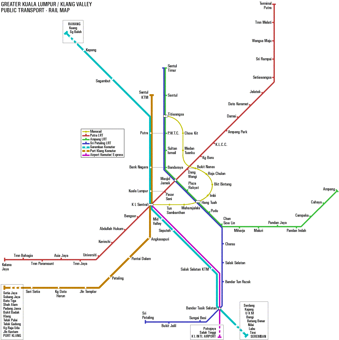
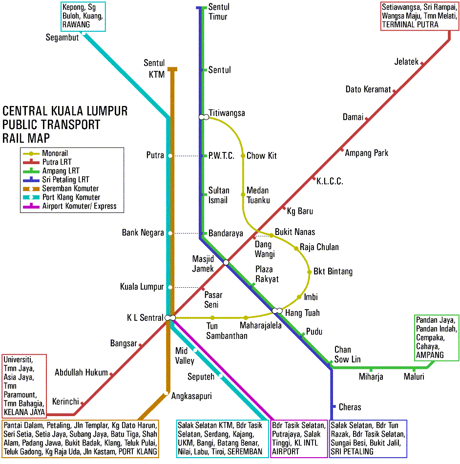
Fed up with the half-baked maps provided by the various rail transport operators, I embarked to do my own integrated map. Note that the map is integrated and the rail system isn't really. In doing the map, I figured out a few things :

• Greater Kuala Lumpur Area - Rail Transport Map = _EPS_195KB / _WMF_395KB
---

• Central Kuala Lumpur Area - Rail Transport Map = _EPS_172KB / _WMF_354KB
---
Just for info, I created the colour-table first (using quarter values) and then selected the actual colours :
| -R- / -G- / -B- | [ ~ ~ ~ ~ ~ ~ ~ ~ ~ ] | |
|---|---|---|
| 191 / _63 / _63 | • BF3F3F | Putra LRT |
| 191 / 191 / __0 | • BFBF00 | Monorail |
| _63 / 191 / _63 | • 3FBF3F | Ampang LRT |
| __0 / 191 / 191 | • 00BFBF | Seremban KTM |
| _63 / _63 / 191 | • 3F3FBF | Sri Petaling KTM |
| 191 / __0 / 191 | • BF00BF | Airport Line |
| 191 / 127 / __0 | • BF7F00 | Port Klang LRT |
| 191 / __0 / 127 | • BF007F | not used |
| 127 / 191 / __0 | • 7FBF00 | not used |
| __0 / 191 / 127 | • 00BF7F | not used |
| 127 / __0 / 191 | • 7F00BF | not used |
| __0 / 127 / 191 | • 007FBF | not used |
---
All graphics created by T. Yahaya Abdullah
Note : You may freely use and copy these files so long as it is not for any commercial purpose. If in doubt, ask me, OK?